Damage Inspections
This app was developed from our legacy Damage Mapping app using the Inspections framework as a base. The idea of Damage Inspections is to do damage mapping on a web-based application, designed to be used with a tablet.
Supported Data Types
The same general information then from other Inspections app are collected.
General
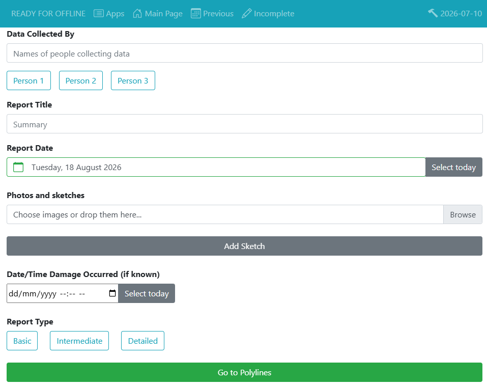
- Report Information
- Who's doing the report
- Report Title/Summary
- Report Date
- Report Attachments (photo, sketch, pdf, etc.)
- Time of Damage
- Report Detail Level
- Georeference with polylines and points
- Attachments to polylines and points
In addition to general information, different levels of details for the data collected are available. The more detailed levels collect data in addition to the lower levels of detail. These are the levels of information available:
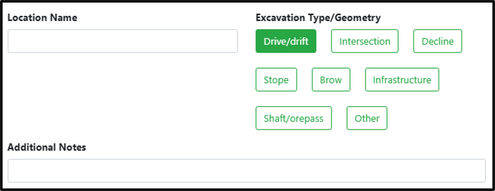
Basic
- Location name
- Excavation Type/Geometry
- Additional Notes
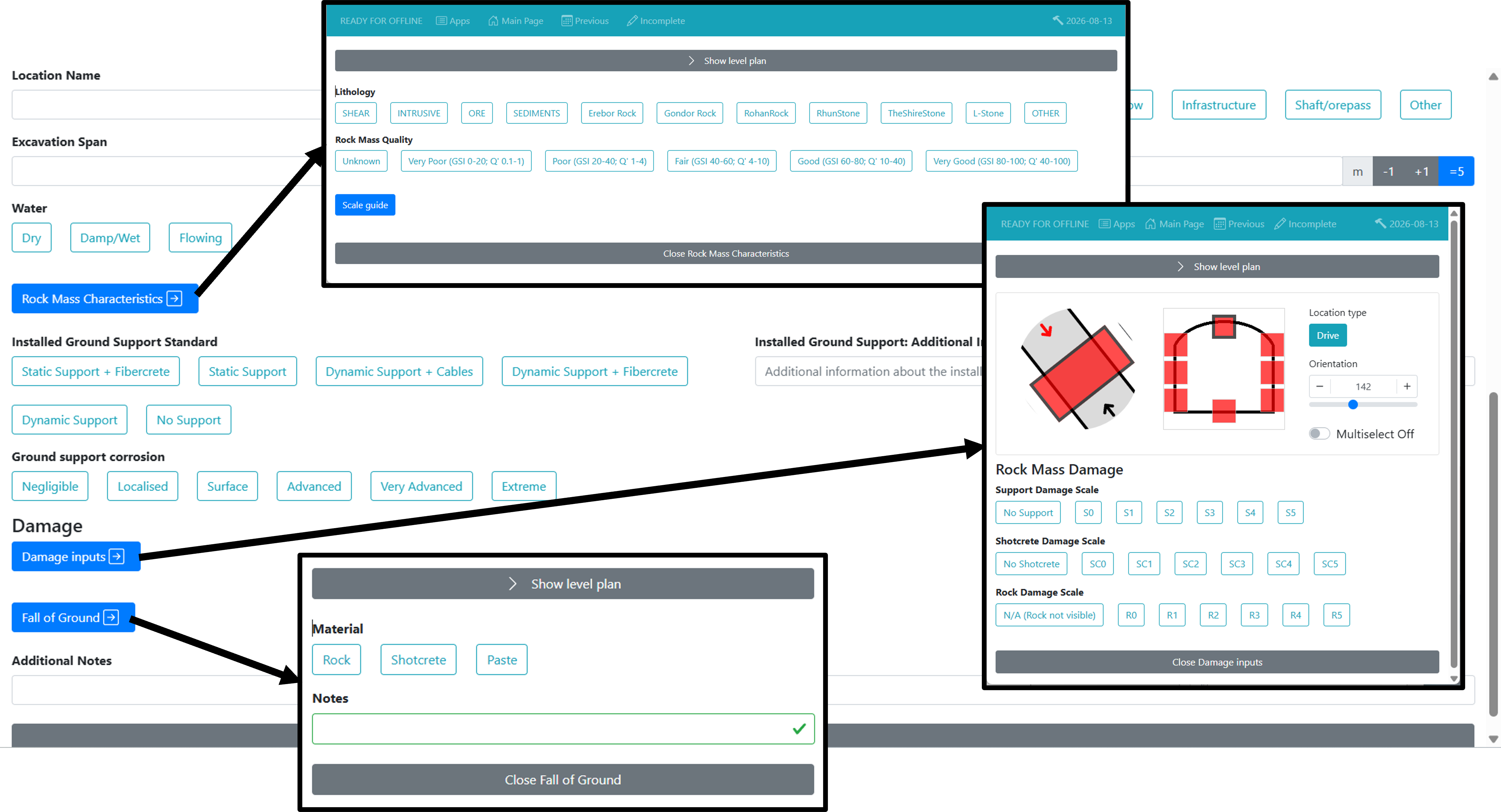
Intermediate (additional fields)
- Excavation Span / Height (note that you can setup the default values of this to be more efficient)
- Water
- Rock Mass Characteristics (Lithology, Rock Mass Quality)
- Installed Ground Support Standard
- Installed Ground Support Additional Information
- Ground Support Corrosion
- Damage Inputs (Profile information like: Location Type, Orientation, Support Damage Scale, Shotcrete Damage Scale, Rock Damage Scale)
- Fall of Ground (Material, Notes)
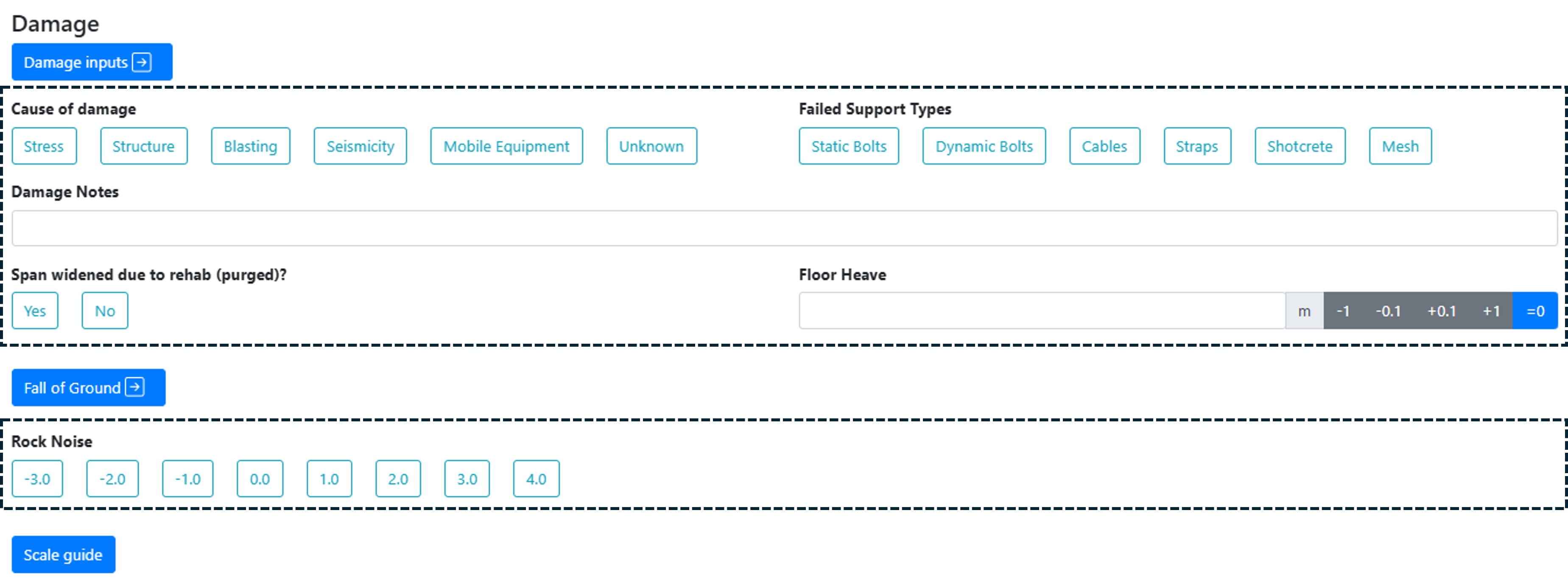
Detailed (additional fields)
- Cause of Damage
- Failed Support types
- Damage Notes
- Span widened due to rehab(purged)
- Floor Heave
- Rock Noise
Key Features
Webforms
All of the features from the other Inspections webforms are available for Damage Inspections webforms (georeferencing, link photo, etc.).
Here are the data entry specific for the Damage Inspections The more detailled is shown in the example, but you can select another levels of detials (Basic or Intermediate) at the Report Info step.
We can setup the default values for excavation height/span (initial default: 5m x 5m). Email us.
Desktop mXrap App
-
Basic Viewer Window: Data import, visualisation and analysis
-
View or Link Photo(s) to a report / line / point
-
Minodes Summary Window: Painted Surveys
-
Link Seismic Event to Damage
A webinar has been held covering this app, click here to listen to the replay.
FAQ
Can I edit my previous reports?
Yes ! It is possible to edit all previous reports from the webserver. By clicking on the Previous on the webserver, you can see and edit all past reports. Cliking the edit will re-open the exact webforms, for which you can edit every piece of data. After done with the edits, submitting the report and importing it in the Damage Inspections app will overwrite the previous data.

Authors
Principal authors: Dan Cumming-Potvin, Matthew Heinsen Egan, Paulus Indra Angkodjojo
Citation
Cumming-Potvin, D, Heinsen Egan, M & Angkodjojo, PI 2026, mXrap software, Damage Inspections, Australian Centre for Geomechanics, Perth, mxrap.com
Publications
No Publications have been done regarding this module yet