Geotech
Purpose
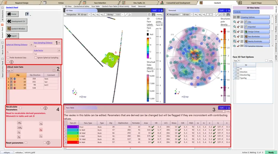
This window will fetch data from a block model, sample boreholes in front of individual stope faces or sample boreholes in the region. Summarise geotechnical parameters per face and calculates factors needed for the Stability Chart.
Steps
- Check mapping variables (distances and priority for association).
- Tick the critical joint sets for factor B Stability Chart calculations. This table is editable.
tip
Individual (or all) parameter columns can be reset to the values originally mapped from geotechnical data.
- Refine geotechnical values in the table view. Tick on the Edit option and double click to change a cell. Pasting values for individual and multiple cells also works.
- Recalculate parameters as prompt. While not strictly required, this ensures calculated factors are consistent with their input variables.
tip
If structural mapping data is available around the stope, use the stereonet to visualise the data and determine the joint sets (use label series to get the dip and dip direction) (use label series to get the dip and dip direction).