Survey Setup
Troubleshooting Survey Display Issues
Survey Input Configuration
Problem: Surveys not visible or positioned incorrectly (far from mine location)
Cause: Incorrect coordinate component order (Easting, Northing, RL) in survey files
Solution:
- Open the Survey Setup window (General Analysis app)
- Locate problematic surveys
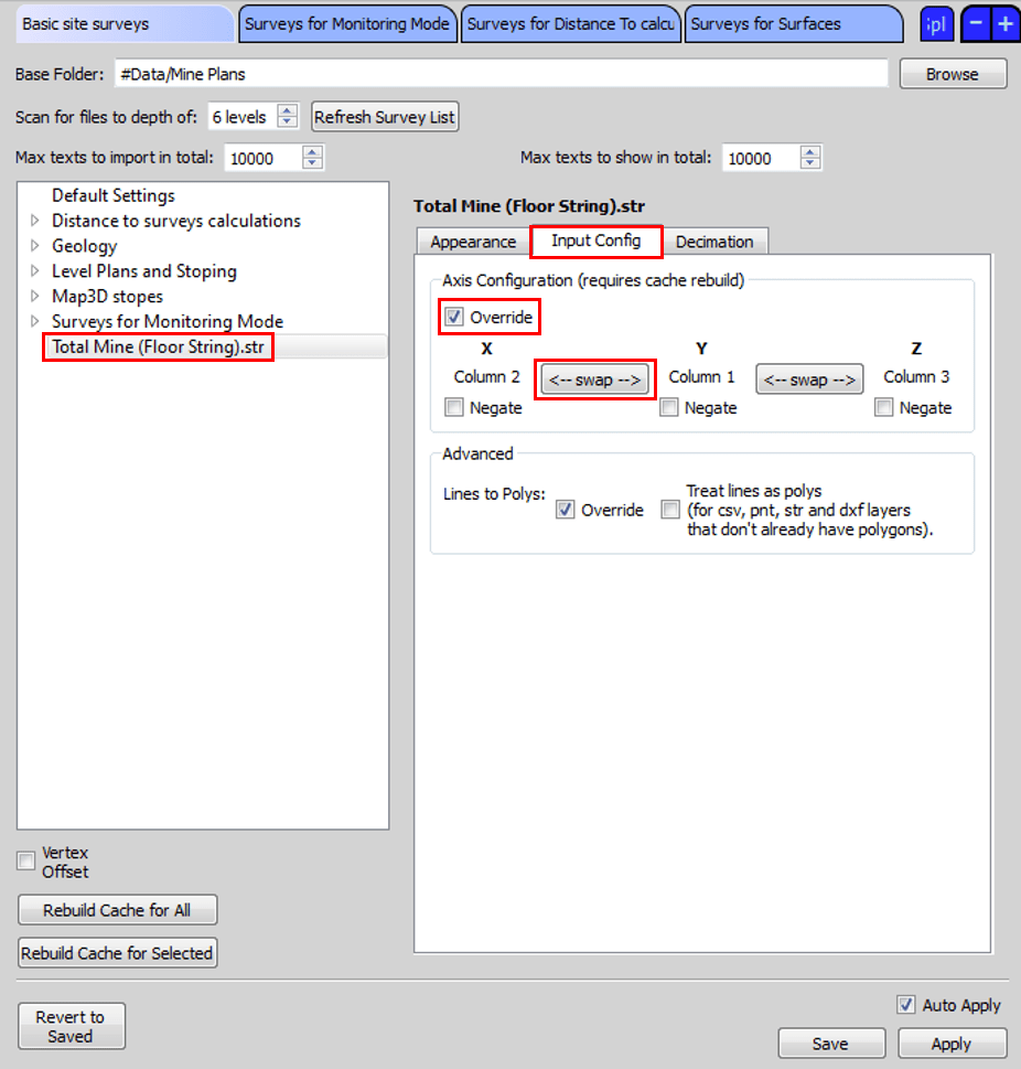
- Click "Input Config"
- Enable override using the checkbox
- Use the swap button to change X and Y column order
- Rebuild cache and save
Performance Issues
Problem: Slow survey loading or difficult 3D View rotation
Cause: Excessive detail in survey files (common with stope CMS files)
Solution - Survey Decimation:
- Open Survey Setup window (General Analysis app)
- Select target surveys
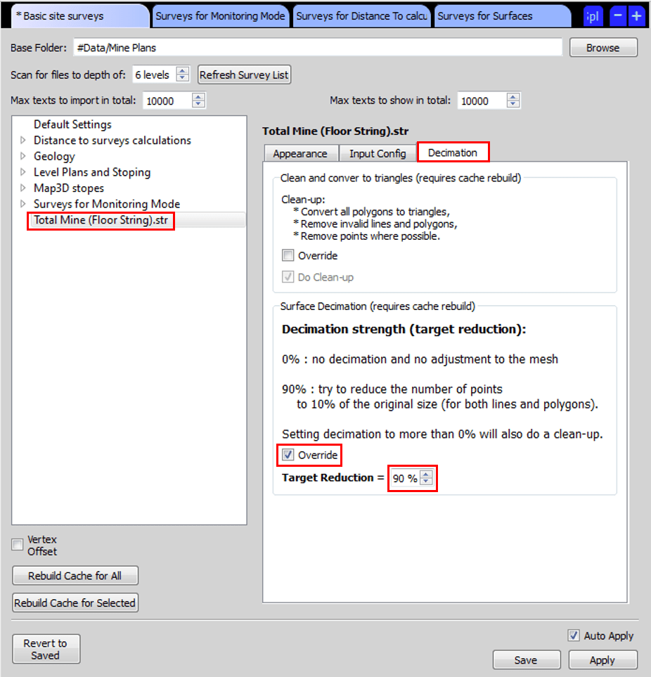
- Click "Decimation"
- Enable decimation override
- Set Target Reduction (60-90% recommended)
- Rebuild cache and save
Managing and Resolving Survey Quality Warnings
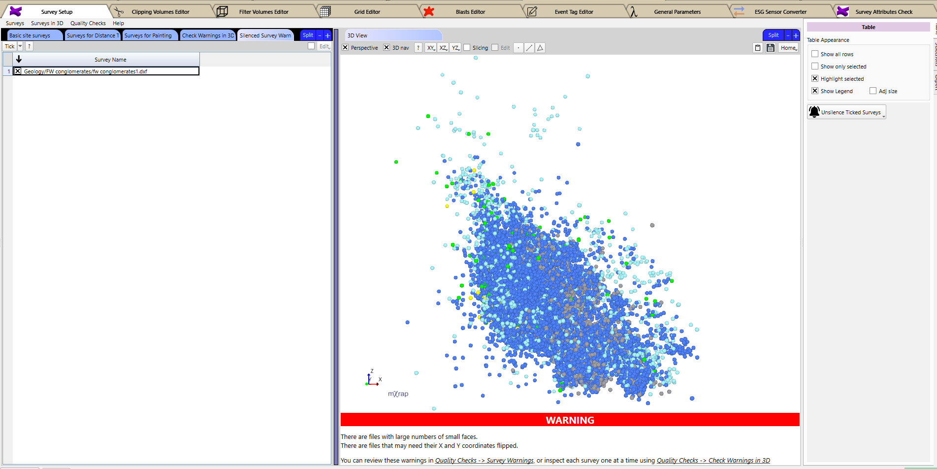
The Quality Checks > Survey Warnings panel provides a diagnostic summary for Basic Site Surveys by flagging three key issues:
- High Face Counts: Files that require decimation to maintain responsiveness.
- Coordinate Flips: Files where X and Y dimensions appear swapped.
- Large Bounding Boxes: Dimensions that may cause 3D View usability issues.
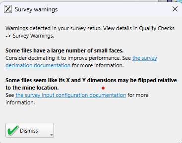
If these issues are detected, a Warning popup will appear, which you can temporarily dismiss.
Use the Quality Checks > Check Warnings in 3D tool to inspect surveys and manage their associated alerts. Warnings can be ignored permanently or ignored temporarily (for the current session only) by clicking the respective buttons.
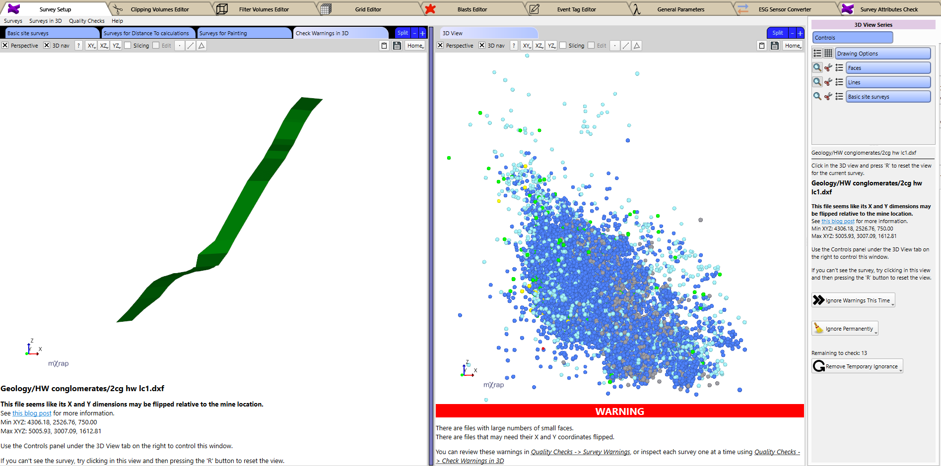
Note: If a survey is not visible, click inside the view and press ‘R’ to reset the camera.
To restore permanently ignored warnings, navigate to Quality Checks > Silenced Survey Warnings, tick the surveys you wish to re-inspect, and click Unsilence Ticked Surveys.
Survey Cache Management
Rebuild Cache
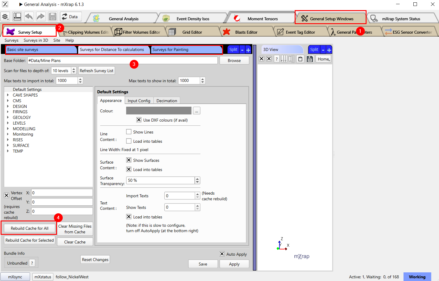
- Navigate to "General Setup Windows"
- Select "Survey Setup"
- Choose the survey cache to rebuild
- Click "Rebuild Cache for All"
This process may take time with large or numerous survey files.
Supported File Formats
| Format | Source | Notes & Compatibility |
|---|---|---|
DCF, VDCL | Deswik | Preferred format (recommended over DXF exports).
|
DXF | AutoCAD | Requires ASCII R14 or 2000 formats (Binary DXF is not supported).
|
DTM, STR | Surpac | Standard mining industry format. |
PNT | Generic | Point cloud coordinate data. |
INP | Map3D | Structural geometry files. |
STL | Generic | Standard 3D mesh format. |
TR, PT | Datamine | Mining engineering software format. |
Below is an example of DXF text shown in the Monitoring application. In this case it can be handy for the control room operator to see where the exclusion areas are. You should start seeing more text series in 3D Views, where you can adjust the size of the text and set to always face the 3D camera during rotation. This may include event magnitude labels, sensor IDs, etc.
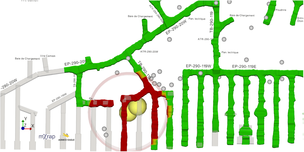
For basic site surveys, you may want to separate your text files from your regular surfaces and lines content so you can turn them on/off independently. Otherwise when you tick a file from the list, all surface, line and text will be displayed together. You can control whether each survey displays its surface, line or text content from the survey import tool.
Colour Support
- DXF colours imported by default
- Auto-correction functions included
- Manual colour override available
Light colours may not display well on white backgrounds. For example, white floor strings are common and will be invisible in mXrap. To prevent this, automatic correction functions are built into the colour settings for DXF, Deswik, and other imported files. You also still have the option to override the colour displayed as before.