2- Build Steps
2- Build Steps Steps are the fundamental building blocks of mine geometry models. Each step represents a discrete volume of excavation at a specific point in time with defined attributes.

Process
To generate a single or multiple (batch) step(s), the main steps are:
1) Associate dates to surveys
- For the manual generation of a single step - The date is manually entered for each step
- For the batch generation of steps - The date is automatically pulled from elsewhere (e.g. attributes, folder, blast)
2) Set step attributes
- Resolution - Determines the dimensions of the blocks used to construct the geometry model
- Type - Classification of the excavation (e.g., Development, Stope, Caving)
- Material - Material classification (e.g., Void, Backfill, Ore)
3) Create steps
-To use it to build models afterwards
- Set accurate mining dates for proper chronological ordering
- Use consistent Type and Material classifications across all steps
- Add descriptive comments to steps for future reference
- Review step attributes before building models
Resolution
The resolution affects both processing speed and volume accuracy. Smaller resolutions provide more accurate volumes but take longer to process. The model will slightly overestimate volume by an amount proportional to the resolution used.
| Resolution | Use Case | Performance |
|---|---|---|
| 1m | High detail for mXrap analysis | Slower |
| 2m | Balanced detail and performance | Moderate |
| 3m | Good for larger excavations | Faster |
| 5m | Whole-mine models, numerical modelling | Fastest |
- Start with 2m resolution for general mXrap usage
- Use 1m resolution only when high detail is critical
- Increase to 3-5m for whole-mine models or numerical modelling
- Consider processing time vs. accuracy requirements
Attributes importance
The date, type, and material attributes significantly affects the final model results. Ensure these are set correctly for each step to achieve accurate time-varying geometry, because it affects the intersection handling
How does the step building work ?
Bounding Box Generation
When you select a survey, the app automatically generates:
- Survey outline - The original survey geometry (purple wireframe)
- Bounding box - Automatic bounds around the survey (adjustable thickness)
- Excavation boundary - The block volume that will be saved as the step
You can override the automatic bounding box if needed to clip specific portions of the survey. However, use this feature carefully - clipping a survey without maintaining a closed surface will result in an incomplete volume.
Block Face Generation
The step building process occurs in two stages:
- Block Faces - Generates the external boundary blocks (typically the longest step)
- Filling - Fills the interior of the boundary blocks using a specialised algorithm (usually fast)
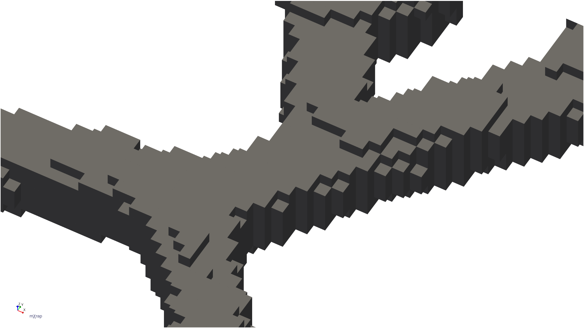
The image above shows how development surveys are converted into block geometry. The app processes the survey to create blocks that represent the excavation volume.
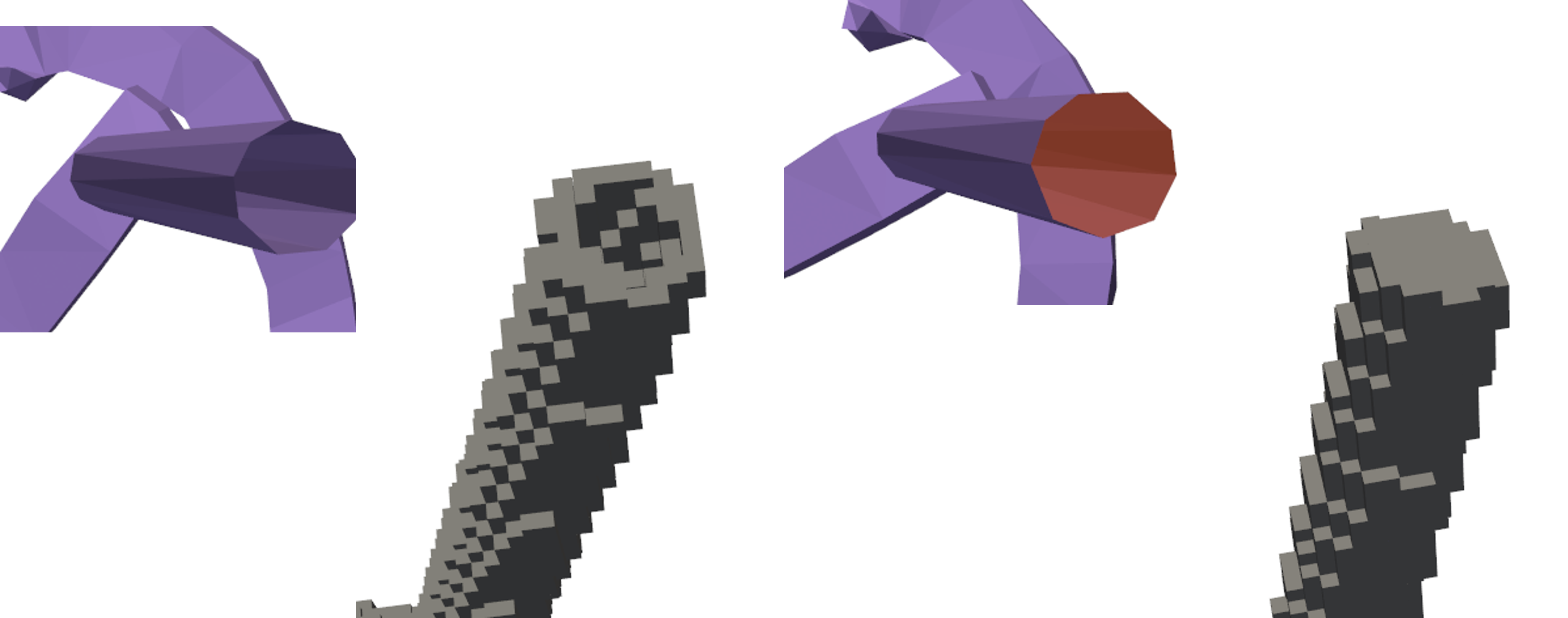
Closed Surfaces Required Input surveys must be closed surfaces with no large gaps. If the survey has missing sections (e.g., a cave shape with the bottom completely missing), the app will only create a shell rather than a proper volume, which will not work correctly in model building.
There is an automatic hole-patching option which can solve certain kinds of holes.
Viewing Options
Use the viewing controls to inspect your step before saving:
- Toggle between survey outline, bounding box, and excavation boundary
- Adjust bounding box line thickness for better visibility
- Use wireframe mode to see the relationship between the original survey and the block volume
- Enable clipping planes to inspect internal structure
Intersection Handling
There are two types of intersection calculations:
Same Type and Material
When two steps have the same type and material (e.g., both are Caving/Void):
- The second date's shell is added to the first
- Only the volume relevant to the second date is saved
- This represents expansion of the same excavation type
Different Type or Material
When steps have different types or materials (e.g., Development vs Stope):
- The intersection volume changes from one type to another
- For example, development that becomes a stope
- The overlapping volume is converted rather than added
Video
Note that this video was made before the batch generate steps options was built.
Troubleshooting
Problem: Step generation fails or produces unexpected results
- Verify the input survey is a closed surface
- Check for large gaps or missing sections in the survey
- Ensure the survey has sufficient detail for the selected resolution
- Try increasing the resolution if the survey is very detailed
Problem: Processing takes too long
- Increase the resolution (larger blocks = faster processing)
- Reduce the survey complexity if possible
- Process smaller sections separately if needed